Sunset Cliffs San Diego: Things to Do & Best Time to Visit

Sunset Cliffs in San Diego: The Local Favorite With Unreal Sunsets
San Diego is packed with places worth building a day around.
Today we’re spotlighting Sunset Cliffs Natural Park, a stretch of coastline that locals love just as much as visitors do.
It sits only about a 20-minute drive from downtown, so it’s easy to work into a day of sightseeing.
If the name is new to you, you’re not alone — but it’s one of the prettiest pieces of shoreline in the city, and well worth a look on your next trip down.
1. What Is Sunset Cliffs?
Sunset Cliffs Natural Park sits at the western edge of the Point Loma peninsula, about a 20-minute drive from downtown San Diego, depending on traffic.
The park protects 68 acres (about 28 hectares) of coastline, split between a narrow ocean-facing strip of 18 acres and a 50-acre hillside section inland.
Golden sandstone bluffs run for roughly 1.5 miles (about 2.4 km) along the water.
Evenings are the main event. The sun dropping toward the horizon with the cliffs in silhouette makes for a golden hour that’s hard to beat, and the park is known as one of the best viewpoints in all of San Diego.
There’s more to it than the sunset, though. Gray whales pass offshore in winter (December through April), and surfing and tide pooling give the park a different feel depending on the season.
A Scenic Drive Along Sunset Cliffs Boulevard
Sunset Cliffs Boulevard follows the curve of the coast, so you get cliff and open-ocean views just by driving it.
The lookout area near Ladera Street is the standout, with sandstone layers running north and south and white surf breaking below.
There is parking, but the spaces tend to fill up on weekends, so a weekday visit usually means a more relaxed walk.
Roll the windows down and let the sea air in, and it’s hard to believe you were in city traffic 20 minutes earlier.
2. The Geology Behind Sunset Cliffs: Rock That’s Still Changing
The cliffs are built from two layers: the Point Loma Formation, laid down on the seafloor about 75 million years ago in the Late Cretaceous, and the Bay Point Formation, from roughly 120,000 years ago in the Pleistocene.
Strike-slip movement along the Rose Canyon fault, along with local compression, tilted the older Cretaceous rock 5 to 15 degrees to the northeast as it was pushed upward, and that’s how today’s terraced landscape took shape.
Waves keep grinding away at the wave-cut platform left behind by Quaternary sea level swings, and the cliff line keeps pulling back, so the view here is still a work in progress.
2-1. Point Loma Formation (Late Cretaceous)
The Point Loma Formation took shape as sand, mud and gravel washed down from ancient mountains to the east and settled onto a submarine fan in deep water.
It’s a sandstone layer several hundred meters thick with shale mixed in.
Fine-grained, hard and dark in tone, it makes up the base that holds up the lower half of the cliffs.
2-2. Bay Point Formation (Pleistocene)
The Bay Point Formation is a softer sandstone deposited in shallow water and beach settings during a high sea level period 120,000 years ago, and because it contains iron oxide, it weathers to a golden color.
It sits on top of the cliffs like a cap, which is what gives the bluffs that distinctive orange glow in the evening light.
2-3. Erosion You Can Still See Happening
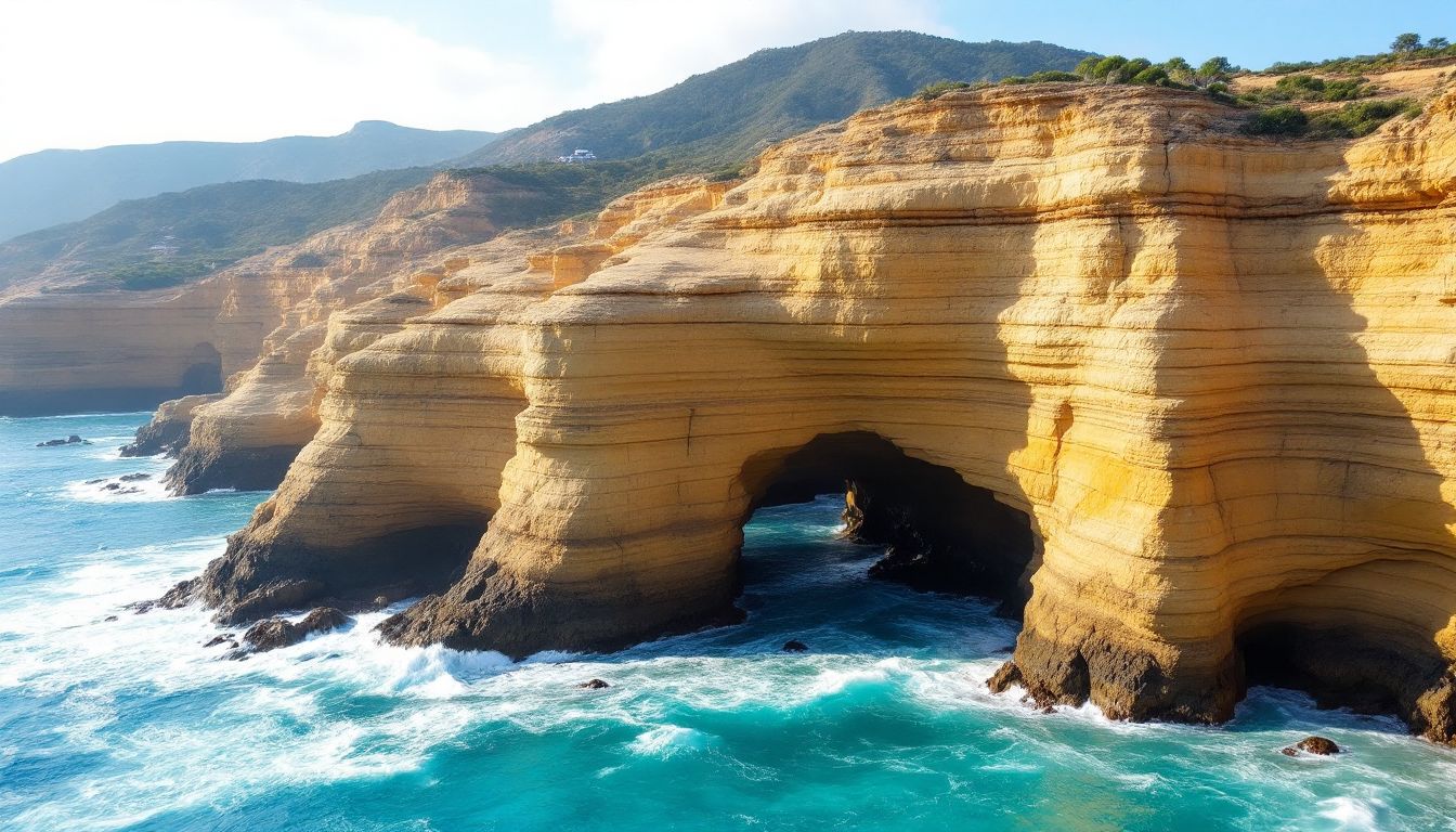
A 1973 study by Kennedy estimated the cliffs had pulled back about 90 cm over the previous 75 years. Later studies have landed on a wide range of figures, partly because the cliffs don’t retreat at a steady pace — long quiet stretches get punctuated by sudden collapses.
Waves work at the base of the cliffs and pick at joints and fractures in the rock, cutting notches, caves and surge channels into the lower face, while rain and runoff wear away the softer layer up top. Sections get undercut until they eventually give way, which is exactly why falls and rockfalls are a real risk here.
Sea caves and natural arches open up where the rock is weakest, and the ledges and hollows that appear at low tide make for some unusual photos.
3. How Did It Become the Park It Is Today?
The Sunset Cliffs you see now is the product of a century of development and preservation work stacked on top of each other.
3-1. Albert G. Spalding’s Vision (1903–1915)
Albert Goodwill Spalding, a former Major League player who went on to build a successful sporting goods business, bought up a large stretch of coastal land on Point Loma in the early 1900s.
He also laid out a golf course on the bluffs west of his home.
Over the years that followed he put about $2 million into cliffside walkways, pebbled staircases, palm-shaded shelters and wooden bridges, creating the scenic route that became known as the Albert G. Spalding promenade.
After Spalding died in 1915, the park passed to the city on the condition that it be maintained, but upkeep fell short and it deteriorated quickly.
3-2. John P. Mills, Home Building and a Rebuild (1924 Onward)
In 1924 real estate developer John P. Mills took the park on, refurbished it and handed it back to the city — again on the condition that the city maintain it — while improving Sunset Cliffs Boulevard and subdividing the surrounding neighborhood.
Mills repaired the cliffside paths and stairs while laying out ocean-view lots, and that work is essentially what shaped the Sunset Cliffs Boulevard you drive today.
3-3. From Subdivision to Natural Park (1983 to Today)
As homes went up, erosion grew more serious and public interest in protecting the views grew along with it, and in 1983 the City of San Diego formally designated the 68 acres along the bluffs as Sunset Cliffs Natural Park.
Since then it’s been managed as a resource-based park with minimal infrastructure, with safety measures like fencing along the cliff edge and closing certain paths, all while protecting the natural landscape.
The city, volunteer groups and research institutions still work together on erosion monitoring and native plant restoration projects.
New Arrivals
Discover our newest arrivals—available now!






































































































4. What Can You Do at Sunset Cliffs?
Beyond walking the bluffs, there’s plenty to do around Sunset Cliffs.
4-1. Surfing
Sunset Cliffs has a run of reef breaks peeling off rock ledges, and the northwest swells that come through from winter into spring bring the best conditions of the year.
Those same rock ledges make getting in and out of the water difficult, so this stretch generally suits surfers who already have some experience.
Conditions swing a lot with the tide, and each break along the cliffs behaves differently, so check a current local surf report before you paddle out.
4-2. Tide Pooling
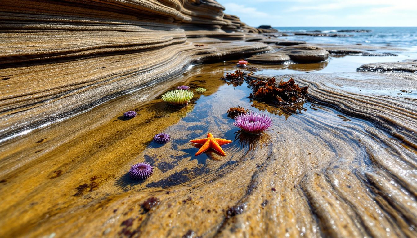
At low tide, countless pools appear across the rock shelf below the cliffs, and you can spot urchins, anemones, sea stars, small crabs and blennies.
Leave the animals, shells and rocks where you find them — look and photograph, but don’t collect or disturb anything, and follow any posted rules.
Slippery algae is everywhere, so wear water shoes with rubber soles and don’t get too close to spots where the waves wash over.
Tides drop lowest around the new and full moon, and arriving about 30 minutes before low tide gives you time to explore before the water starts coming back in.
4-3. Whale Watching
Through the winter, gray whales head south from northern feeding grounds to Baja California, and they pass by again on the northbound trip in spring.
You can watch for them from the bluffs, though they travel well offshore, so a clear look takes patience.
Binoculars help a lot: what you’re really scanning for is the spout, not the whale itself.
Clear mornings are easier for spotting since you’re less likely to be looking into the sun, while afternoons can give you a shot at silhouettes against the setting sun if a whale does surface.
5. When Is the Best Time to Visit?
5-1. Tips for Shooting Golden Hour
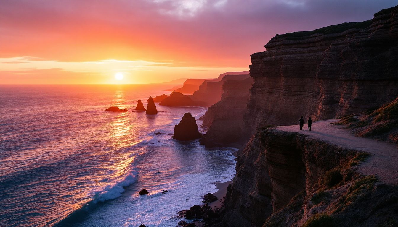
The low angle of the setting sun is what makes the sandstone glow, and watching the sky shift from purple to orange behind the cliffs is the whole reason people show up at that hour.
Get there well before sunset. The parking near Ladera Street tends to fill up long before the sun goes down, so build in extra time to find a space, even on a weekday.
5-2. When Is the Best Time to Spot Whales?
Gray whales start heading south in early December, with the peak coming around mid-January.
Once the southbound groups have passed, the northbound migration follows through spring, with mothers and calves the last to make the trip.
Calm days and overcast skies help more than anything: less chop and less glare means a spout stands out.
5-3. Weekday and Early Morning Plans to Beat the Crowds
Weekend afternoons fill the street parking with visitors and surfers, so if you’d rather skip the crowds, a weekday morning gives you a much better shot at a space.
And if low tide lands early in the morning, you may get the tide pools to yourself, with the low morning light adding depth and contrast to your photos.
Driving down from the LA area? Sunset Cliffs is the kind of place you want to reach on your own schedule, since the best light lands right around sunset. Our Hybrid Rental is an easy, fuel-efficient way to make the trip and string a few Point Loma stops together in one day.
6. Other Spots Worth Adding Nearby
There are a few more great stops close to Sunset Cliffs, so it’s worth stringing them together into one trip.
6-1. Old Point Loma Lighthouse
Standing on a hilltop inside Cabrillo National Monument, the Old Point Loma Lighthouse is a historic lighthouse first lit in 1855.
It sits about 128 m (roughly 420 feet) above sea level, and the grounds around it look out over San Diego Bay and the Pacific in every direction.
Inside, the keeper’s living quarters have been restored as a museum, with 19th-century navigation materials like lenses and charts on display — a treat if you’re into history. Climbing the tower itself is only possible on special open-tower days, so check what’s open before you go.
Follow the trails through the park and you can also walk the clifftops with the Pacific spread out in front of you.
6-2. Point Loma Tide Pools
Down below the bluffs on the ocean side is a wide tide pool area known as the Point Loma Tide Pools, where low tide reveals plenty of anemones, sea stars, crabs and small fish.
The rock here is hard Point Loma sandstone with striking curved bands, and paired with the clear pools it’s a popular photo spot. The surface turns slick wherever algae grows, though, so wear closed-toe shoes with good grip and keep an eye on the waves.
The best window runs from about an hour before to an hour after peak low tide. This stretch sits inside the monument, and the shoreline area closes earlier than the park gates, so check current hours before you build a plan around it.
7. Final Thoughts
Sunset Cliffs Natural Park is one of San Diego’s finest viewpoints, a place where 75 million years of geology and a century of development history overlap.
The moment the golden sandstone catches the setting sun delivers drama and stillness at once, in a way photos and words never quite capture.
Tides, parking and seasonal conditions all shift, so it’s worth checking current City of San Diego park information and a tide chart before you head out.
Go see that mix of ocean and cliffs for yourself, and make it a highlight of your San Diego trip.
We share plenty of other great spots on Instagram, so come take a look!
You May Also Like